Louisiana Coastal Wetland Loss
Remote Sensing Project
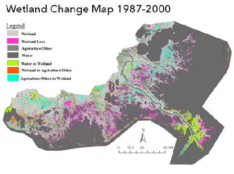
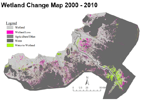
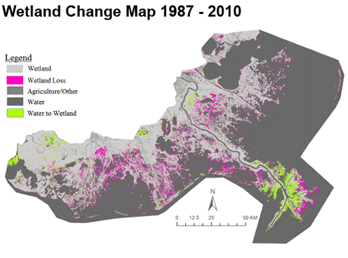
The objective of the remote sensing project was to quantify wetland loss in the Louisiana coastal region between 1987 and 2010 using Landsat 5 satellite images, as well as NAIP aerial images for classification accuracy assessments. We determined the net loss by examining a mosaic of four Landsat images for each of the three study years in the month of October. To examine whether the rate of wetland loss has increased or decreased, we generated three change maps: 1987-2000, 2000-2010, and 1987-2010. The map represents the transformation of the coastal wetlands over a twenty-three year period.
Software: ERDAS Imagine & Esri ArcMAP for Desktop